

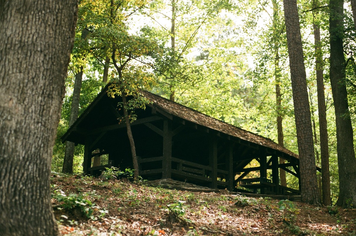
Here’s a view of a building in a South Carolina forest, but where is it? Send your guess to feedback@statehousereport.com. And don’t forget to include your name and the town in which you live.
Our previous Mystery Photo
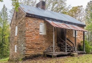
Our Dec. 4 photo, “Old stone cabin,” stumped one reader, a geologist who thought the stones were “meta-mudstones of the Carolina Slate Belt. Figuring that cabin builders use what’s available locally, I’d place this cabin in or near the Slate Belt counties — McCormick, Greenwood, Saluda, Newberry, Farfield, Lancaster, Chester, or York. The trees and topography also indicate that this cabin is well above the fall line.”
He was pretty close because the old cabin is the Oconee Station blockhouse near Walhalla, as related by several readers, including George Graf of Palmyra, Va.: “Originally a military compound and later a trading post, Oconee Station State Historic Site offers both recreational opportunities and a unique look at 18th and 19th century South Carolina. Oconee Station, a stone blockhouse used as an outpost by the S.C. State Militia from about 1792 to 1799, and the William Richards House, are the only two structures that remain today.”
Allan Peel of San Antonio, Texas, shared that “However, according to the information provided by the South Carolina Department of Archives and History here, as well as information included as part of the application to the NRHP here, Oconee Station was actually “erected before 1760 to afford the few settlers nearby a measure of protection against numerous Cherokee Indians in the area. It was the last of three guardhouses built by Lt. Col. Archibald Montgomerie, who commanded English and Scottish troops in ill-starred 1762 attacks on Cherokees. The building marks the farthest point in South Carolina to which white settlers ventured prior to the Revolution, and is believed to have housed British soldiers, at least periodically, until after that war.”
Others who correctly identified the structure were Jay Altman of Columbia; Frank Bouknight of Summerville; Henry Eldridge of Tega Cay, Elizabeth Jones of Columbia; Keven Mertens of Greenville; and William Jennings.
A hat tip to reader Thomas Jacobsen in Alaska for providing the photo.
- Send us a mystery: If you have a photo that you believe will stump readers, send it along (but make sure to tell us what it is because it may stump us too!) Send to: feedback@statehousereport.com and mark it as a photo submission. Thanks.
ORDER NOW: Copies are in Lowcountry-area bookstores now, but if you can’t swing by, you can order a copy online today.